Dara Sakor
Digital Twin City
A salesperson can say "it's close to the sea and the roads are in" a hundred times. It works better to let the buyer fly in from 3,000 metres and look for themselves. This is the digital twin I built for Dara Sakor: real terrain, satellite imagery and roads, running in a browser.
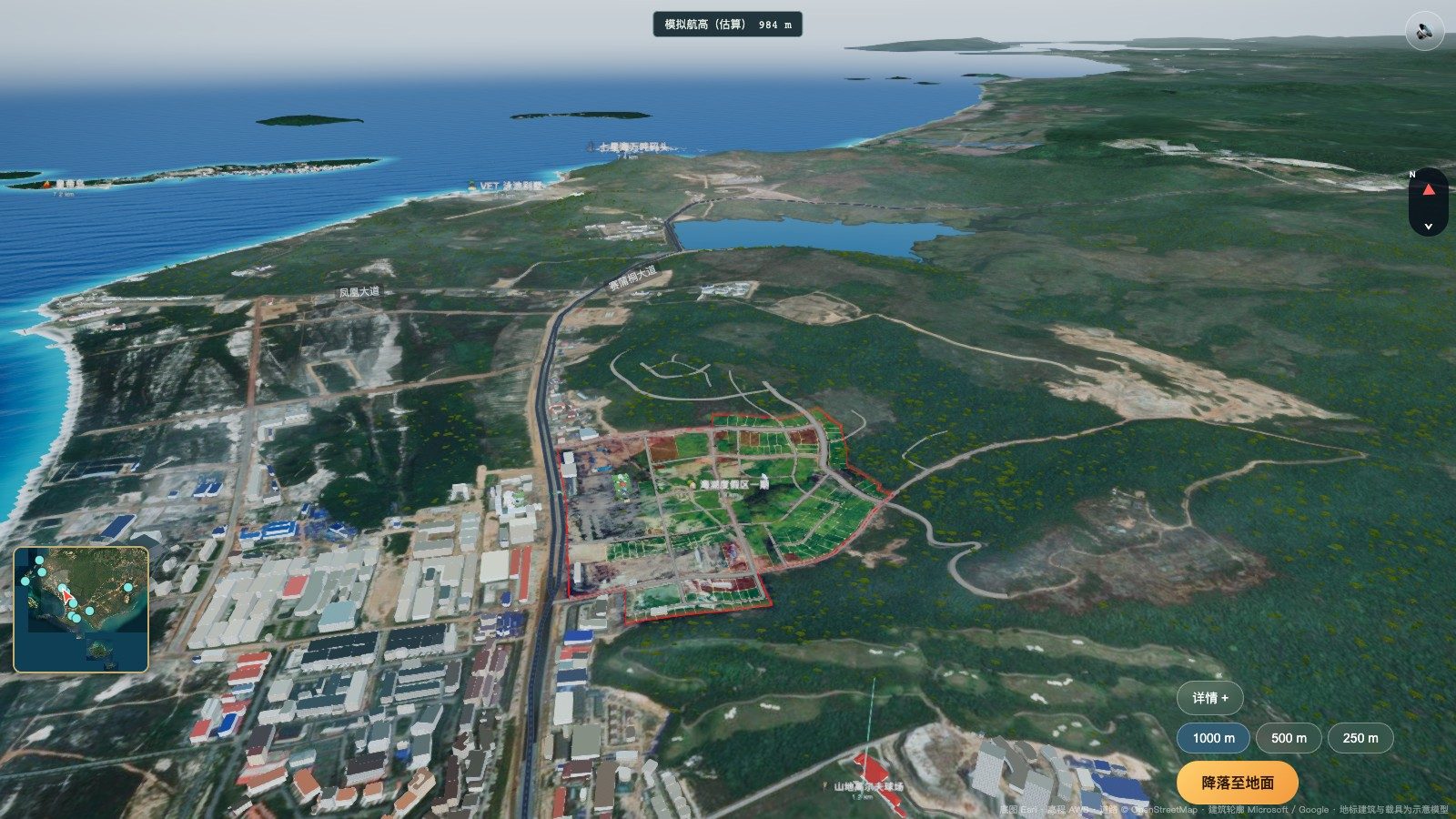
Dara Sakor Digital Twin City is a 3D model of Dara Sakor (Koh Kong province, Cambodia) that runs in a web browser. It is built on public elevation data, satellite imagery and the OpenStreetMap road network, and it carries all 348 numbered plots of Soksan Sakor Land (Residential Land) Phase I (30 ha). Open game.shvvilla.app — no download, no sign-up — to look over the roughly 360 km² land area of the project, take a 10-stop helicopter day tour, and fly into Phase I. Available in Chinese, English and Khmer; designed and built by me, launched in October 2026.
Why build it
I wrote earlier about the Dara Sakor land sales system: a map plus a plot card answers "where is it, how much, and can I trust the numbers". But buyers who have never been here also ask things a flat map can't answer — how far is the sea really, which way is the airport, what has already been built around it? That is a sense of scale and direction, and normally you only get it by standing on site.
Getting here is not hard — Phnom Penh–Dara Sakor flights run twice a week, about 45–50 minutes one way — but for most buyers a trip is still a decision. The twin gives them a first visit on screen, so they can decide whether to make the real one.
What you can do
1. Overview: see where Dara Sakor is
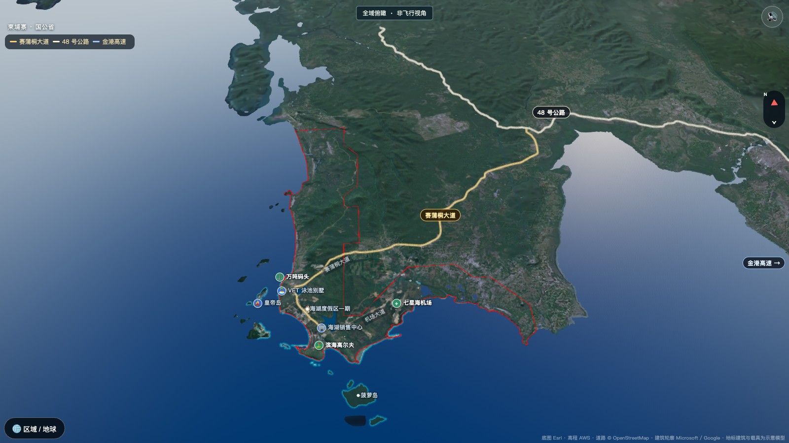
You start with a high oblique view of the whole project. A thin red line marks the project area; the three trunk roads — Say Phuthang Blvd., Highway 48 and the Phnom Penh–Sihanoukville Expressway — light up together every so often, each labelled on the road. Airport, port, coastal golf, Phase I and Pineapple Island are marked with small icons. Drag with one finger, pinch to zoom and rotate; zoom further out to switch to the regional and globe map.
2. "See Phase I first": a 60-second approach
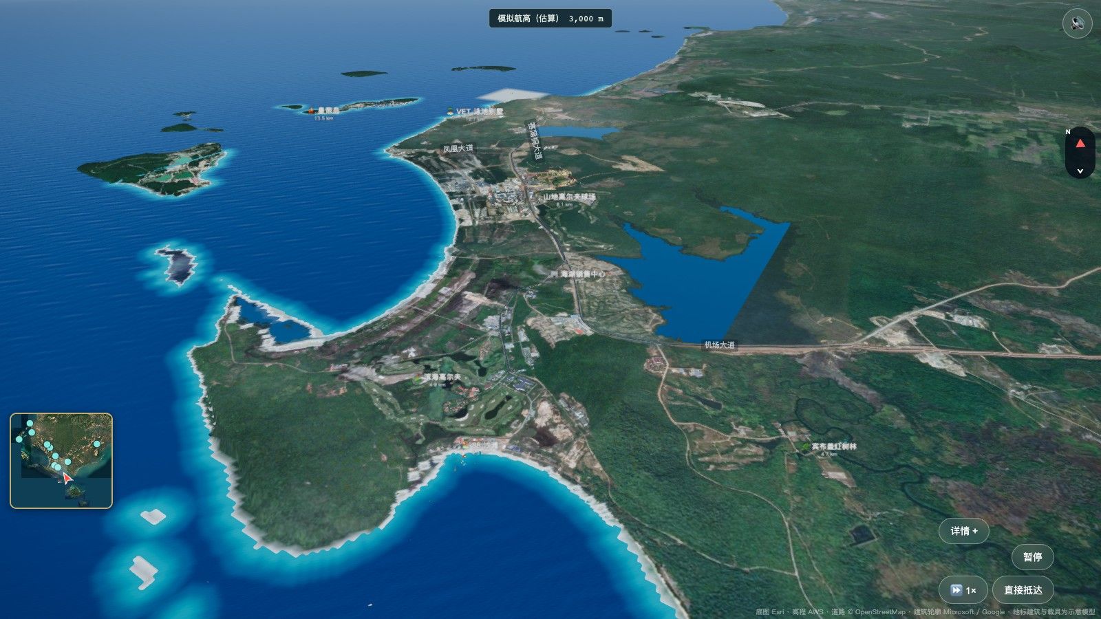
The most important route in the system — the video above. It starts 3,000 m above Pineapple Island (Koh Manous) with the nose on Phase I, cruises level, then descends gently past 88 Beach, the coastal golf course, the sales center and the already-developed strip along Say Phuthang Blvd., ending in a hold 1,000 m south-east of Phase I. 60 seconds at 1x, with 2x, 4x or "arrive now". After that, the buyer chooses: 1,000 / 500 / 250 m, drag to look around 360°, then "Land".
3. A 10-stop helicopter day tour
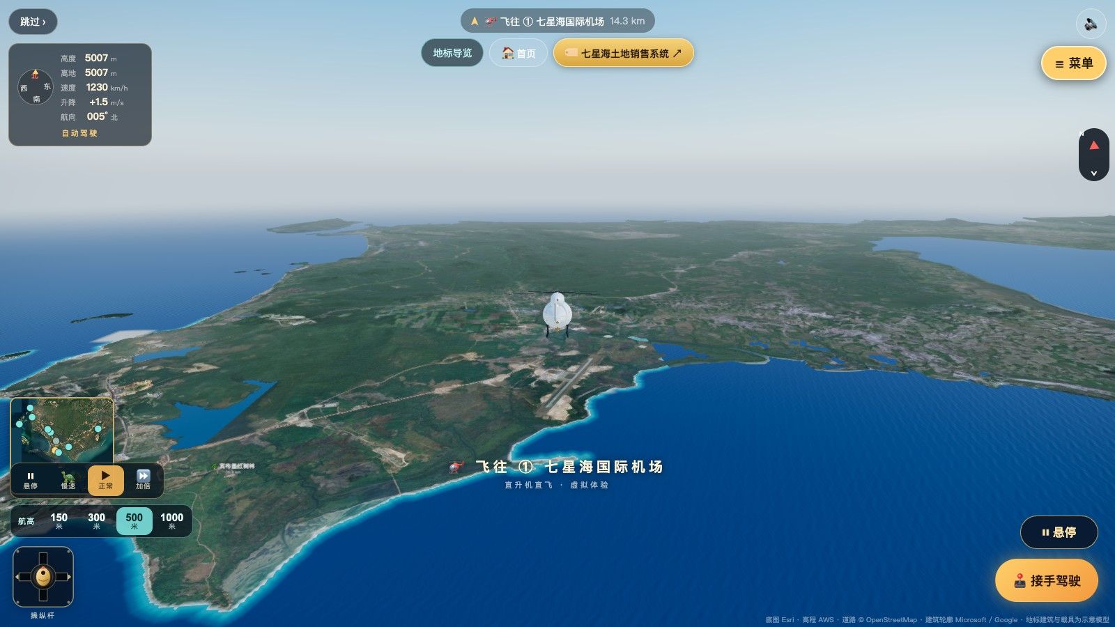
The helicopter is the only way to travel. Between stops it follows the trunk-road corridors at 500 m above ground; you can look around at any time or take the stick. The stops:
- Dara Sakor International Airport (watch an airliner land)
- Peam Kay Mangrove
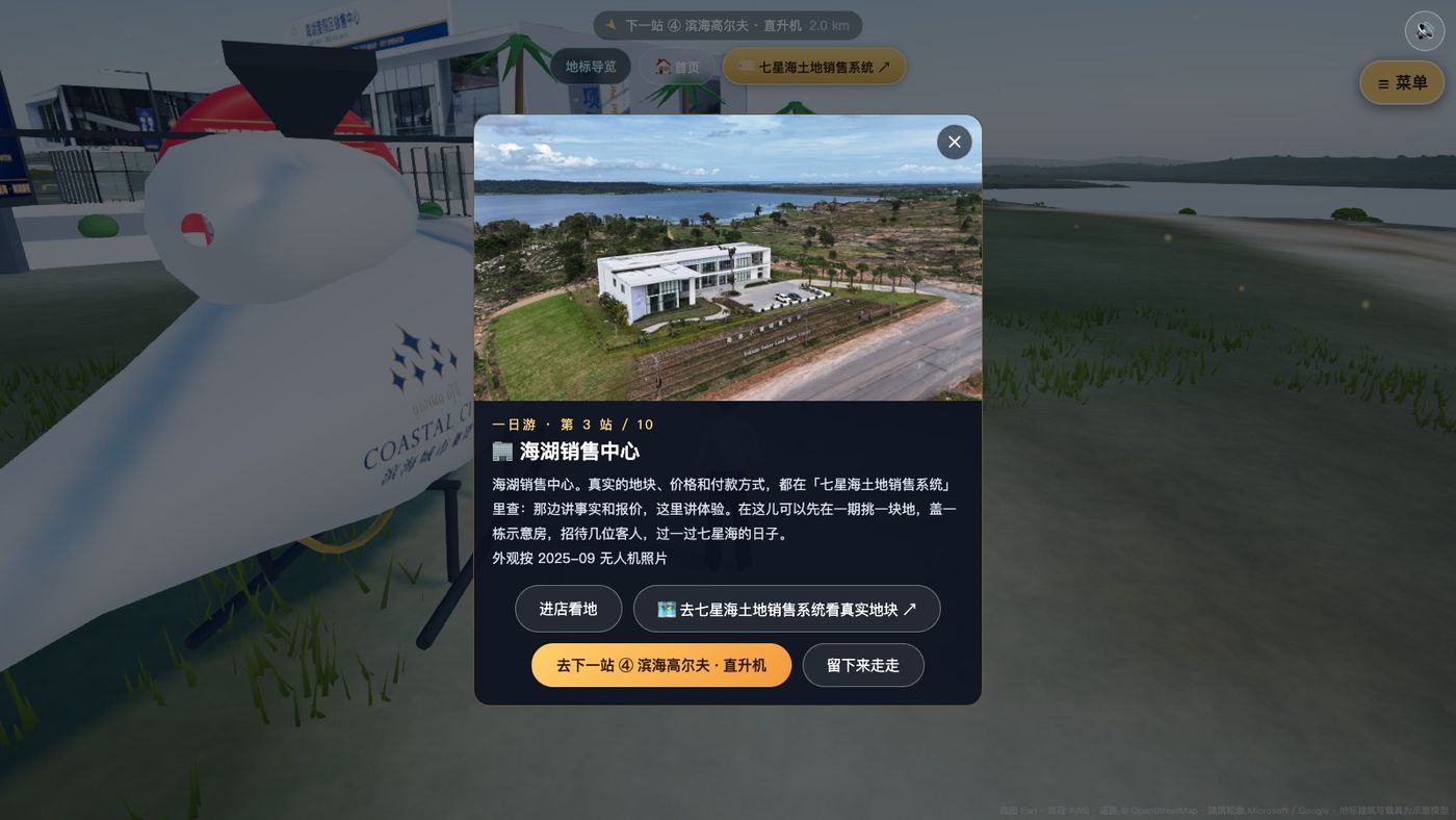
- Phase I sales center
- Coastal golf course
- 88 Beach
- Mountain golf course
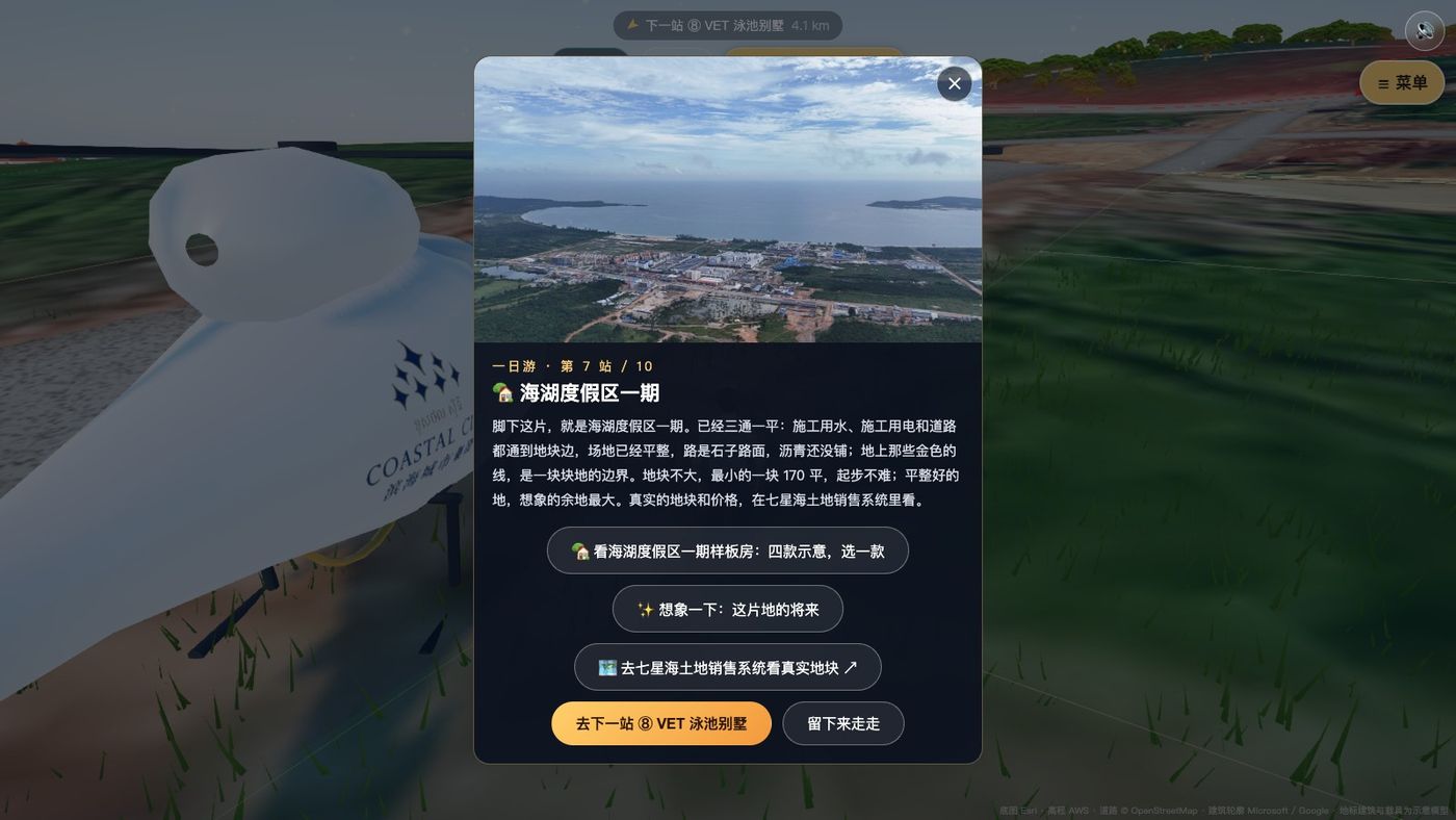
- Phase I
- VET pool villas
- Koh Sdach (a neighbour, not part of the Dara Sakor project)
- Dara Sakor port
4. Visit the sales center
The sales center's exterior follows September 2025 drone photos; façades the drone did not capture are illustrative. Step inside and my avatar — a 3D figure rebuilt from my own photos — walks into the hall, where a 2.8 m screen plays the project film; real plots and payment plans are one tap away in the land sales system.
5. Phase I: today's empty land, and what it could look like
At Phase I the card starts with the plain fact: Phase I is still empty land today. Utilities and grading are done and the gravel roads between plots are open; asphalt is still to come. The smallest plot is 170 sqm. Two more buttons — four show-house types and "imagine this land's future" — are clearly marked as illustrations, not company plans and not products for sale. Real plots and prices live in the land sales system.
What is real and what is simulated
✅ Real data
- Terrain: AWS public elevation (from SRTM, about 15 m grid in the core area)
- Imagery: Esri World Imagery; capture dates vary by area
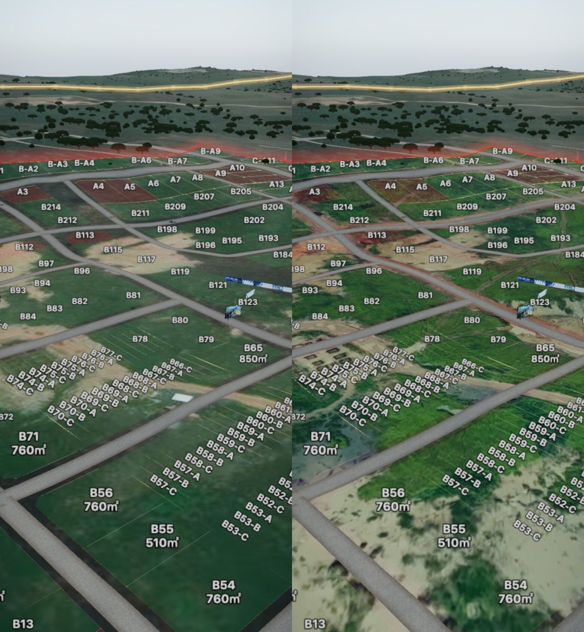
- Phase I ground: drone orthophoto, about 0.25 m per pixel
- Roads: OpenStreetMap
- About 3,000 building footprints from Microsoft / Google open data, re-traced on recent imagery where needed
- All 348 Phase I plot outlines and numbers match the land sales system plot for plot, checked automatically before each release
📐 Inferred
- Building heights, estimated from footprint, roof colour and drone photos
- Helicopter altitude, from public elevation; may differ on the ground by a dozen metres
🎨 Illustrative
- Building looks, tree species, vehicles
- Show houses and "future" scenes: not plans, not for sale
- Helicopter speed, sped up several times
From a game to a sales tour
Honestly, the project took a detour. When it started in mid-October 2026 it had cars, motorbikes, yachts, diving, golf, mini-games, house-building and postcards — it was turning into a game. Visitors played instead of looking at land, and each round of changes answered only that round's feedback, undoing earlier requirements. On 27 October I cut it back to the overview, the helicopter, Phase I, the sales center and contact, and wrote a single current spec that every later change is checked against. The test for any feature is one question: does it help the buyer see this land and this area more clearly?
Tech stack
Rendering: three.js + TypeScript + Vite, pure front-end WebGL; MapLibre for the regional and globe views. Distant terrain loads in two tiers (low-res first so the scene can open, high-res after); the Phase I orthophoto and landmark models load by distance once you are in. The first load is a dozen-plus MB — Wi-Fi recommended.
Data: AWS Terrarium elevation (SRTM), Esri World Imagery, OpenStreetMap roads, Microsoft / Google Open Buildings footprints, and a Phase I orthophoto stitched from drone photos with OpenDroneMap.
Same numbers as the land sales system: plot prices in the twin use the same formula and the company's approved pricing; availability comes from the land sales system's live inventory.
How it was built: started 15 October 2026; two weeks and 200+ commits, built with AI coding tools such as Claude Code. AI writes the code, runs the tests and takes the screenshots; a human sets the spec, makes the cuts and checks the result against site photos.
FAQ
What is the Dara Sakor Digital Twin City?
Do I need to install an app? Does it work on a phone?
Is the imagery real?
Is Phase I built yet?
What right does a buyer get?
Where is Dara Sakor and how do I get there?
More on the location, access and what is built today: Dara Sakor area guide.
Is this a company system or a personal project?
Open it, or talk to me
All screenshots and the video were recorded from the production build on 2026-10-29 and are simulated imagery. Prices and terms are governed by the formal sales contract; this article is not investment advice.
Sources: 360 km² is the project land area (F-132); 348 numbered Phase I plots (F-106); Phase I is empty land today (F-112); 99-year long-term leasehold use right, certificate valid until 2107 (F-044, F-141); Phnom Penh flights twice weekly, 45–50 min, bookable (F-053, F-136); English project name (F-036).