Dara Sakor
Land Sales System
Buying land across the sea, the hard part is not paying. It is not being able to see the site and not knowing whom to trust. This system puts three things on one map: where the land is, what it looks like, and how to pay for it, with every number traceable to its source.
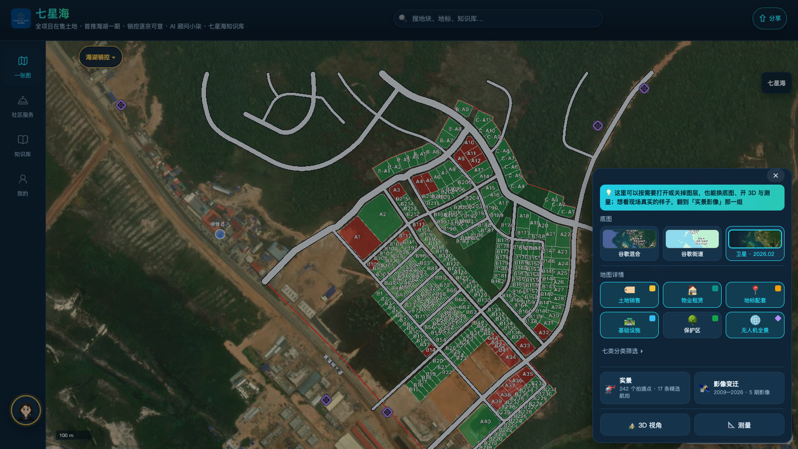
Intro: three things a buyer wants to know first
Since June 2026 I have been Sales Director of Phase I at Dara Sakor in Koh Kong province, Cambodia, selling small plots within an area of about 30 hectares.
After a few months, the customers' questions turn out to be very focused: Where is the land? What does it look like? How do I pay? One layer deeper: Who said this number, and can it be trusted?
Most customers are not in Cambodia. They rely on a few pictures, some voice messages and a PDF from a salesperson. What year was the picture taken, how was the area measured, is the price the latest version? All of that comes down to "trust me". In the traditional way of selling, certainty is the scarcest thing.
So I built a land sales system for Phase I that puts those three things on one map and lets customers open it and look for themselves. It does not replace the sales advisor. It is the same sheet, with sources you can check, in the hands of both advisor and customer.
Why a sales director wrote the system himself
My training is in land resource management, and I have worked for many years with GIS, remote sensing and spatial data. Earlier in Sihanoukville I built a real estate rental and sales map, which showed one thing: in a market where information is scattered, what is missing most is one map that shows the whole picture and lets you check the source.
At Dara Sakor the problem looks different: information is not scattered but far away. Plot boundaries sit in CAD drawings, prices and payment terms in signed-off documents, site photos in drones and phones, official material in dozens of PDFs and articles. What customers get is always second- or third-hand.
In my view, the most effective way to sell land is not to say more, but to reduce the places where a customer has to rely on trust to get across. So our slogan is: we sell poetry and distance, and we sell certainty too.
What works today: one map, six parts
The system is already live. Open qxh.shvvilla.app in a phone browser, WeChat or Telegram; you can also add it to your home screen. The parts below follow the order customers actually use them.
1. Find the land from the globe: location and availability
On opening, the view flies from the globe to Dara Sakor and lands on Phase I. The basemap is satellite imagery from February 2026, with layers for roads, landmarks and infrastructure. Every Phase I plot is coloured by status, with for sale and reserved shown in different colours and counted separately. This is inventory, not hype: customer and advisor see the same map of what is still on sale.
2. Tap any plot: the plot card
Every plot has its own card: number, area, length and width, distance to the sea, elevation, nature of the right, and payment plans calculated on that plot's actual area. The right is always written as "99-year long-term leasehold use right", so the problem of different salespeople describing it differently disappears at the source. The drawing or signed-off document behind each number is marked on the card; prices and terms are governed by the formal contract.
3. See the site without flying: real imagery
The map is dotted with capture points: drone aerials, 360° panoramas and site videos, each marked with its date. You can also switch between satellite imagery of past years and compare the same spot year by year. What the site looks like now is decided by the date on the photo, not by a brochure.
4. Ask directly: AI advisor Xiaoqi
Xiaoqi answers questions in Chinese, English and Khmer about prices, payment, the nature of the right, transport and amenities, and contract terms. It does not chat at random: for prices it calls the quotation tool and works from approved terms, for documents it searches the official originals and shows the source. What it cannot answer or is unsure about goes to a human advisor.
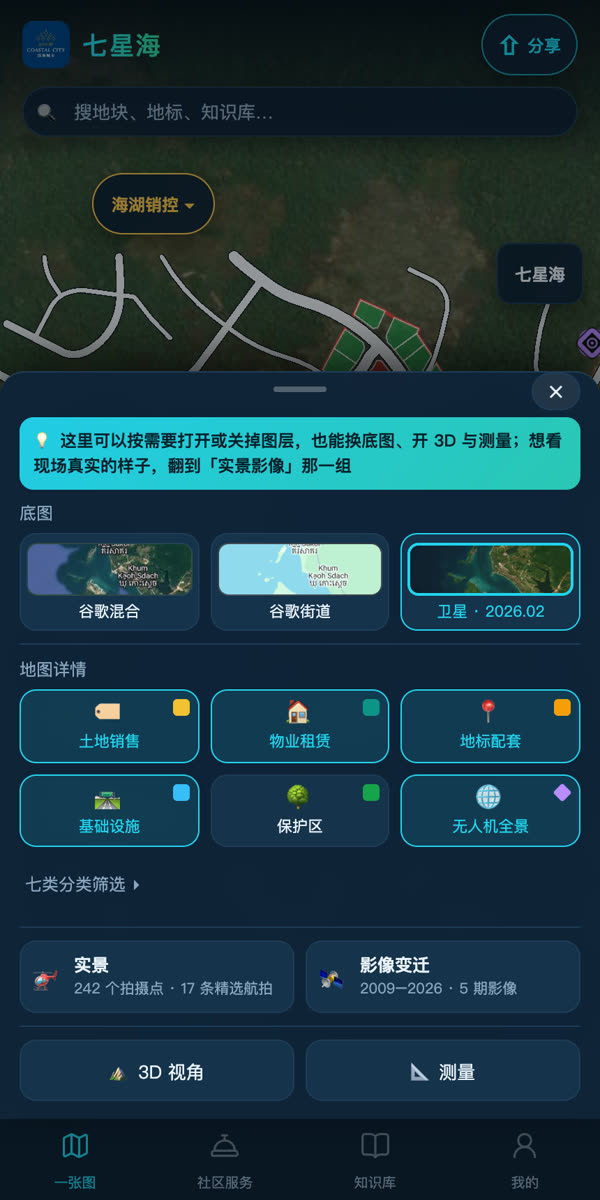
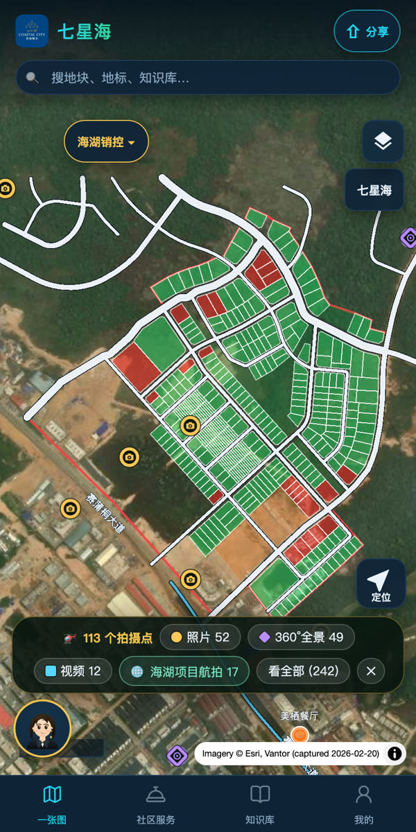
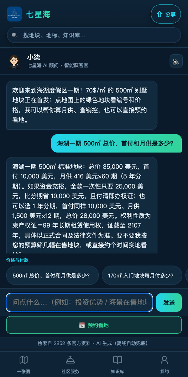
5. No digging through chat history: knowledge base and trust center
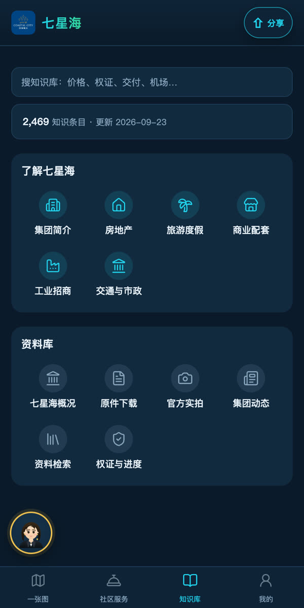
The group profile, master plan, transport and utilities, official site photos and project originals are organized into topics, and each entry and original can be opened directly. The trust center puts the most common questions up front: what the data is checked against, what a 99-year long-term leasehold certificate is, and how it is processed.
6. Book a visit, plus a promotion card for peers
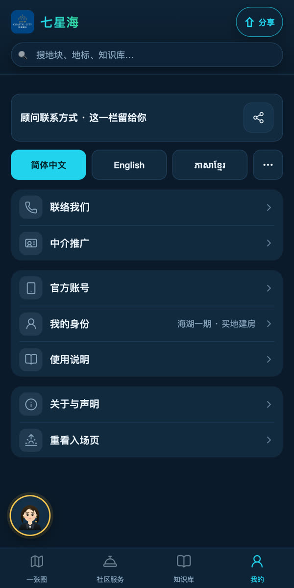
One tap on the plot card books a site visit: leave a time and contact, and a sales advisor confirms the trip. The system is open to all advisors and agents. Fill in your own promotion card once under "Me", and every link and plot share card you send carries your own contact details. Whoever's link brings the customer in follows up with that customer.
Tech route in three sentences
As with the Sihanoukville system, I avoid jargon where I can. The backbone of this system is three sentences: every number has one source → every outward-facing sentence passes a gate before it goes out → one map delivered to any entry point.
Sentence one: every number has one source
Prices, areas, payment plans and the nature of the right are all written in a single fact base. Each entry carries a number, a sign-off status and its evidence source: signed-off entries may be used externally, pending ones are internal only. The map, plot cards, Xiaoqi, posters and short-video copy all read from this one base. When a price changes, it is changed in one place and the whole system follows; an outdated price does not live on in some corner.
Sentence two: every outward-facing sentence passes a gate first
In land sales, the thing to fear most is one sentence said too far. So I wrote the red lines for outward content as machine rules: promising returns, misstating the nature of the right, or promising immigration status gets blocked on the spot, and key numbers without a source get flagged. A draft that has not passed the gate does not go out.
Sentence three: one map, delivered to any entry point
It is a web app that can be added to a phone home screen. No app download is needed, and a link forwarded in WeChat, Telegram or WhatsApp opens it. On the sales center's big screen it can go into guided mode with one tap, and ten steps run themselves.
Technical details (for technical readers; others can skip)
Front end: a React + Vite + TypeScript PWA; maps use MapLibre, and the large number of plots and 3D terrain are rendered with deck.gl; the interface has 11 languages.
Back end: Vercel serverless + Edge, billed per request and auto-scaling; leads and events are written to Upstash KV and pushed to the sales team's Telegram.
AI advisor: a large language model (DeepSeek) with tool calls. Quotes go through a deterministic quotation tool and the model does not do the money maths itself; document answers are retrieved from chunks of the official originals and carry their source.
Data: plot boundaries are vectorized from the management committee's DWG drawings, and length, width and area are measured from the geometry; the fact base and red-line rules are maintained in one place and called from everywhere in the system.
Build pace: started in July 2026, with more than 1,500 commits so far; every outward-facing number must be traceable to a source and signed off before it goes live.
The Sihanoukville real estate sales and rental map solved "information is too scattered", and its core was collecting data and understanding plain language. The Dara Sakor system solves "trust is too far away", and its core is one source for every number and one gate before every sentence goes out. The underlying "one map" idea is the same.
it is saying too much.
A few facts you can check yourself
You do not have to take my word for it. You can check these points now:
- The system opens right now: qxh.shvvilla.app. No sign-up and no booked demo needed.
- Tap any plot: its area, length and width, nature of the right and payment plans are on the card, ready to compare with the quote your sales advisor gave you.
- Every site photo and aerial is marked with its date, so you can compare it against satellite imagery of past years.
- Ask Xiaoqi a price question and see whether the answer shows its source.
FAQ
Is the price in the system the final price?
What right does a buyer get?
What if the AI advisor is wrong?
I am an agent or a peer. Can I use it?
Is this a company system or a personal project?
Want to see the land, or just talk?
Open the system
Contact me directly
For site visits, trip bookings and channel partnerships:
One map handles "numbers and contracts". To get a sense of scale and direction first, see the Dara Sakor Digital Twin City: in your browser, fly in from 3,000 m to Phase I and take a helicopter tour of 10 stops.
Finally
What this system does is not complicated: it puts a plot's location, look and payment plans on one map and lets every number find its source. It solves one specific problem, "across the sea, what do you rely on to believe?" It does not replace the sales advisor or the contract.
All screenshots here were taken from the production site on 2026-10-15, and the system link opens right now. Prices and terms are governed by the formal contract; this article is not investment advice.
Basis of figures: 348 numbered Phase I plots, about 30 ha for Phase I and the 99-year long-term leasehold use right all come from signed-off entries in the project fact base (F-106, F-033, F-044).